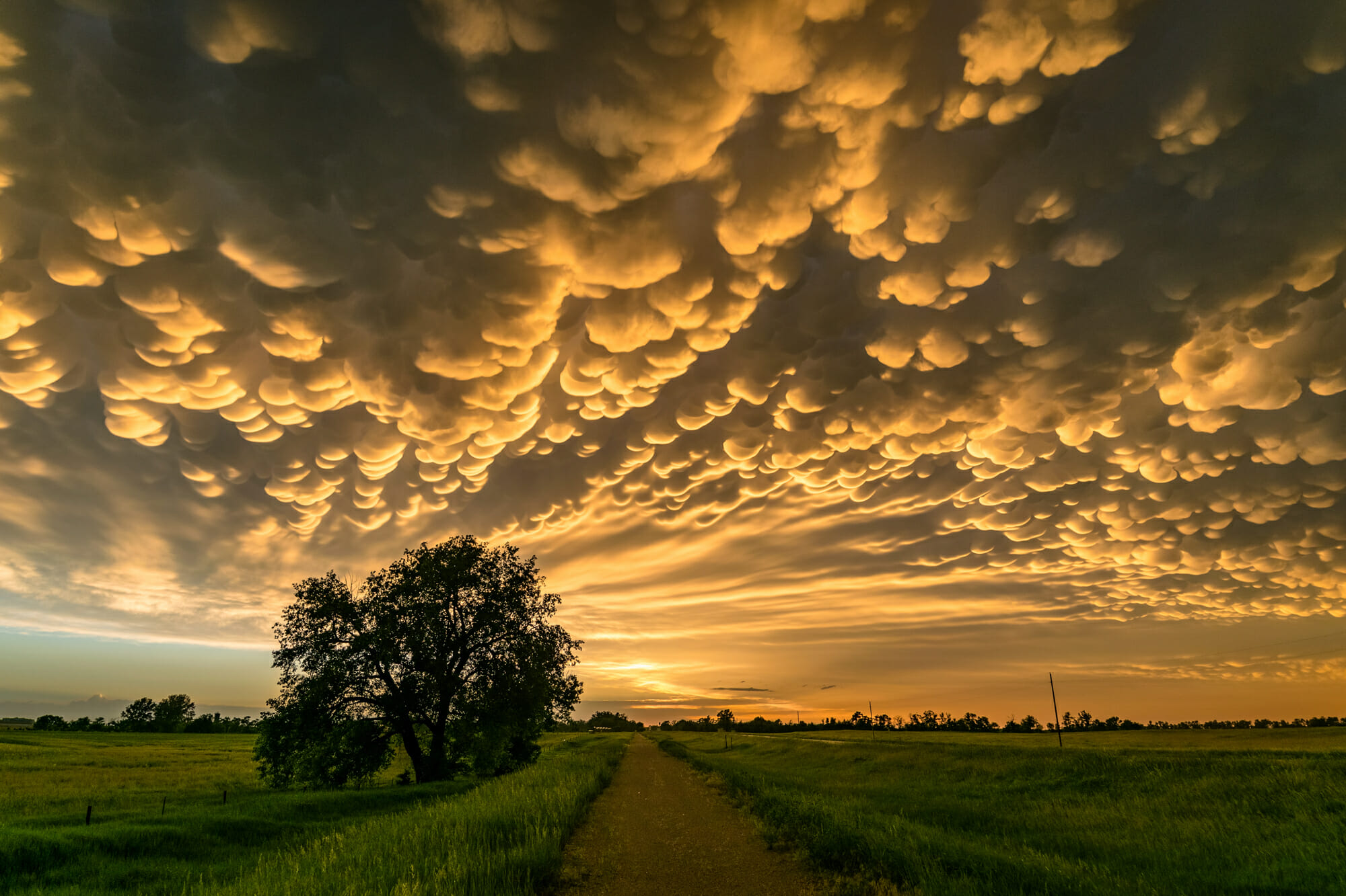
As summer lingers and thunderstorms continue to increase, you might see an unusual weather phenomenon – a mammatus cloud. (In pronunciation, the stress is on the first syllable.) This cloud is formed when cool moist air sinks into warm dry air, which is the opposite of how most clouds are formed.

Clouds are typically formed when there is moisture present and the temperature and dew point are equal, i.e., 100% saturation. Clouds form when sunlight is reflected by the earth’s surfaces and warms the air around it. This warmer air rises and as it rises into the atmosphere it decreases in temperature. If it stays warmer than the air around it, it will continue to rise. When these molecules of air reach the point where the temperature has cooled enough to equal the dew point and moisture is present in the air, these molecules of air will then begin the process of forming a cloud. This process is called sublimation. If these molecules of air continue to be warmer than the air around them, they will continue to rise. This is the start of a cumulus cloud. If there is enough lifting force, moisture and instability, this cloud can develop into a thunderstorm.
Mammatus clouds are most commonly found with extreme thunderstorms. Mammatus clouds look like pouches hanging from a cloud. Typically they are found on the underside of the anvil of a thunderstorm or extend from the base of a cumulonimbus cloud. Additionally, they can also be found under altostratus and cirrus clouds and volcanic ash clouds. Typically, the moisture inside these clouds is composed of ice crystals.
Mamma is a Latin word, which means ‘udder’ or ‘breast’, which is attributed to the appearance of the cloud – much like a cow’s udder. These clouds can stretch for hundreds of miles in any direction and are said to last between ten to sixty minutes.
For the longest time, I believed that these clouds were associated with tornadoes, but this is not always the case. In researching this topic, I learned that they typically form in the dissipating stage of a thunderstorm on the underside of the anvil after the upper-level winds have blown the top off and these dense moist cold air particles have lost their updraft and begin to descend back to the earth into warmer dry air. Some of my research has indicated mammatus clouds may form because of a tornado, but seeing mammatus clouds, does not mean there is a tornado associated with that towering cumulonimbus cloud.
While these clouds can create amazingly beautiful, awe-aspiring sunsets and cannot necessarily be associated with severe weather, it is highly recommended to avoid flying in or around them as they are generally associated with turbulence, wind shear and icing. Enjoy the sight, but only from a safe distance.


