When it comes to weather phenomenon, a deeper understanding of formation allows pilots to better understand the associated risks and prepare more thoroughly for a flight. In the case of fog, knowing when a certain type is likely to form is especially helpful as weather reports and forecasts lack the ability to specify different types of fog (with the exception of freezing fog). Though fog forms throughout the year, certain types are much more prevalent during the winter months and warrant individual discussion. Analyzing each type separately brings to light the different risks that each one poses and how long each may stick around remaining an aviation nuisance.
Before diving into the types of fog that are common winter hazards, let’s briefly review how fog forms. Simply, fog is a surface-based cloud. In order to form, there needs to be little to no difference (spread) between the temperature and the dew point. A dew point at any given time is the temperature to which air must be cooled to become saturated with water vapor. Digging in a bit further, the spread can be reduced by decreasing the surface temperature to the dew point, or by increasing the dew point to the current temperature – which is done by adding moisture to the air- or a combination of both actions. When this occurs, the moisture in the air will condense and produce fog. The manner in which the fog forms determines how it is classified.
Radiation Fog
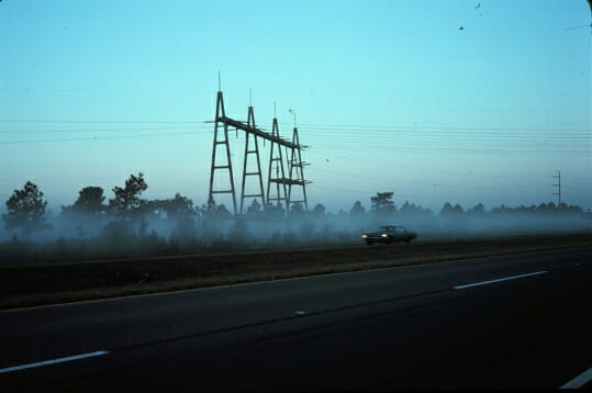
Forming under conditions consisting of little wind, a clear sky, and relatively high humidity, radiation fog is commonly seen in the evenings through early morning. Through terrestrial radiation, the ground cools after sunset thereby cooling the air above. Once the air’s dew point is reached, water vapor condenses, and fog is formed. Radiation fog needs calm conditions to be sustained; it will dissipate with wind speeds greater than 10 knots or with the rise in temperature that occurs after sunrise.
Advection Fog
Often seen in coastal regions, advection fog occurs when warm, moist air moves over a cooler surface. This can occur over both land and water but is formed the same way, regardless. Advection fog requires wind to form, and the stronger the wind (up to about 15 knots), the more widespread the fog. As the wind speed increases above 15 knots, the fog is lifted and will form low level stratus clouds.

Steam Fog
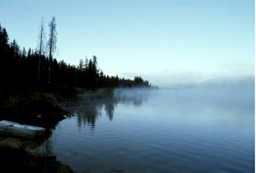
This type of fog occurs when cold, dry air over land moves over warmer water. As water evaporates, it very quickly condenses once it reaches the colder air above. Named because its appearance resembles steam rising from the water, steam fog can result in low level turbulence and potentially dangerous icing conditions. The impact of steam fog is dependent on the size of the body of water over which it forms. Generally speaking, the bigger the body of water, the more widespread the fog.
Freezing Fog
Fog that occurs when the temperature is at or below 0°C/32°F is classified as freezing fog. Water droplets in freezing fog are supercooled; they exist in liquid form but will freeze on contact with a surface. Freezing fog can provide significant icing impacts and deserves extra attention when known to exist at your departure point or destination. In a situation involving freezing fog, it is crucial to understand the de-ice/anti-ice capabilities of your aircraft. It may be very difficult, if not impossible, to operate when there is freezing fog in the area, especially when additional threats like freezing rain may be present. This is the one type of fog that can be indicated on METARs and TAFs and will appear with the qualifying descriptor “FZ” before the obscuration code for fog, “FG”.
Ice Fog
Not surprising given the name, ice fog consists of very small ice crystals suspended in the air. The conditions for the formation of ice fog are similar to those of radiation fog, but with frigid temperatures of roughly -30°C/-22°F and below. Due to the very low temperatures required, it is mostly a threat in the Arctic and Polar regions, but still possible in parts of the United States during the winter months. A big issue with ice fog (aside from the fact that you have found yourself somewhere so unbelievably cold) is that visibility can be severely reduced if you are flying into the sun.
A greater understanding of fog can make a big difference when it comes to making safety decisions. In both air carrier and general aviation operations, fog has the potential to disrupt operations and cause dangerous icing scenarios. By understanding what conditions may result in fog’s formation and dissipation and respecting the threats it may bring with its ability to form very quickly, you can feel more confident on those cold, foggy winter days.


