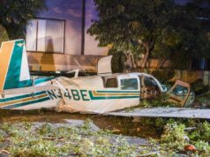
The FAA defines turbulence as air movement created by atmospheric pressure, jet streams, air around mountains, cold or warm weather fronts, or thunderstorms. Although turbulence cannot always be predicted, weather products and tools allow pilots to adjust their flight paths when mountain wave turbulence indicators are present. On occasion, mountain wave turbulence can lead to loss of aircraft control and is considered a severe threat to aviation.
One of the most valuable weather tools is Pilot Report, or PIREP. PIREPs, whether from a light- or a transport-category aircraft, are transmitted to ATC and disseminated to potentially dozens of aircraft within the vicinity. When making a PIREP, ensure you follow proper reporting criteria and be specific, particularly when relaying the intensity level. Also, be cognizant that information provided within a PIREP relates to conditions for the reporting pilot’s aircraft and may not extrapolate accurately to your aircraft. Moderate turbulence upon a 777 may be severe upon a smaller aircraft, for example.
In addition to PIREPS, the FAA Aviation Weather Center disseminates SIGMETs (significant meteorological hazards) for any moderate or greater turbulence within the CONUS (continental U.S.). Graphical weather products are particularly valuable, enabling pilots to plot a route of flight while determining if a SIGMET will be a threat. Accordingly, adjustments to a route can then be made both laterally and vertically.
Winds and temperatures aloft can also be an indication of the presence of shear, which can then be correlated to mountain wave turbulence. Noting the location of the ridgeline, pay attention to rapid increases in wind speed. Pilots may not always be able to visually identify mountain wave turbulence. At times, breaking waves and rotors can be given away by visual clues in the sky. If sufficient moisture is in place, altocumulus standing lenticular clouds (ACSL) can develop at the top of individual waves above and downwind of mountains producing a mountain wave. Remember, the absence of cloud formations does not guarantee the lack of wave. If present, clouds would be parallel to the mountains from which they are developing.
Satellite imagery is likely to depict cloud patterns but fails to provide pilots with accurate altitude information. These clouds will look like ripples of water on satellite. Thus, pilots are encouraged to incorporate satellite products into their preflight planning, while acknowledging the limitations inherent to its usage.
Predicting mountain wave turbulence accurately involves the use of a wide range of meteorological products and resources. A single tool is unlikely to reflect an accurate representation of the conditions. While some products are forecasts, others reflect real-time information, such as PIREPs. Hence, proper planning requires inferring information from each product and applying it to your planned flight path. As with any flight, situational awareness of the enroute environment is key.


