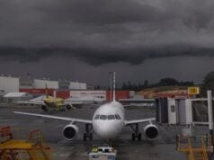
HEAT BURST
A heat burst is an extraordinarily rapid increase in temperature. Though rare, they often occur at night and can be accompanied by ferocious winds. In one case, the surface observation temperature increased 15 degrees in 20 minutes. If that doesn’t get you thinking, maybe the 90 MPH wind gust recorded in another heat burst will get your attention.
Simply, heat bursts occur as the result of the downdraft dominated decaying thunderstorm. There are specific meteorological conditions that need to exist in order for a heat burst to occur. (I will leave the technical explanation of a Heat Burst to the NWS and the link that I provided above.) What I want to bring to your attention is the application of that knowledge of a heat burst has to your flying and decision making.
It’s in the A.T.I.S.
You’re on your last leg into KMCI. It’s midnight and you left EWR late! You’re tired. Fortunately, the weather in Kansas City is VFR. The ACARS ATIS comes across with nothing notable, VFR as you thought, and you continue. Ten minutes later, a new ATIS pops up. You notice the temperature is 15 degrees warmer than was previously reported. You pay this no mind. Obviously, it’s a typo. You also missed that this ATIS was a SPECIAL! You get another ACARS ATIS (another SP) with the winds showing 58 kts, and you laugh. It’s good VFR, no synoptic or even mesoscale weather features are around your destination. This is all wrong. Or is it? Just keep going!
Tonight, you also happen to be stretching out your fuel a little bit. You’re going to land right at reserve. So what! The weather is good and on a night like this, you don’t need to be ultra conservative.
You’re about to find out that there were no typo’s in the ATIS. It was all real.
News Flash!
The temperature really did go up 15 degrees along with an uptick in the winds to 58 knots. And guess what? Because of your fuel, you’re landing in Kansas City tonight. Like it or not. You will probably not like it!
Missed opportunity!
When you started receiving the ATIS, you were still 40 minutes out and still on with en-route center. You were also right over St. Louis. Nobody thought to tell you and you certainly didn’t ask, “What’s up with the Kansas City weather?” Why would you? The ASOS was obviously malfunctioning. Now that you’re closer to MCI than STL, your hand has been forced to land. If you go missed, you’re in a bit of a pickle.
The Moral of the story?
Know about the existence of heat bursts. If a dissipating thunderstorm is near an airport of intended operation, beware! I know you are already privy to this notion of caution as it pertains to thunderstorms and proximity to airports. This is one of the reasons why the guidance we receive as pilots exists. But be extra careful in this regard.
A heat burst is the downdraft or outflow from a thunderstorm. You could also think of it as a gust front. I’d also suggest a micro- or macro-burst in the neighborhood. A heat burst achieves its status by the increase in temperature. This inrease in temperature is a red flag to the potential of extreme winds. Said another way, this increase in temperature is a precursor to what might come next which might include:
- Wind shear.
- Moderate or greater turbulence.
Heat burst scenarios are said to be rare. Their onset is not typical of how we interact with thunderstorms proximal to airports of operation. We are all aware of the hazards of an approaching storm and one that is building. But are we alert and attuned to dissipating thunderstorms? Can you see a thunderstorm when it no longer has lightning and is just green on the radar? That’s a serious question.
The scenario I presented was approximately what happened to me a few years ago. Fortunately, I verified that the weather was indeed real. And thankfully, the winds abated before our approach. But alas, had things not improved, my hand would have been forced under precarious conditions. The good news was that I had some knowledge and understanding of what was happening. The first officer was not nearly as excited as I was!
Be aware of heat burts, their implications to your decision making and pay very close attention to ATIS reports that seem out-of-whack when it comes to temperature and winds. Give these “errant” METARs merit and ask questions of ATC and dispatch.


