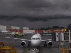
I bring to your attention the existence of low-level jet streams or “low-level jets” (LLJ), as they are sometimes called. Some guidance on LLJs might promote better situational awareness (SA) and help you be safer the next time you fly.
I am not a Meteorologist and I am quick to disclaim any special weather knowledge above and beyond what any professional pilot should know about the atmosphere, which holds true for this information. My efforts are to trigger your interest and awareness.

The jet stream
You already know the definition of and the effects jet streams (upper-level) can have on aircraft. See the basic definition here: jet stream | Wind Maps | Weather Underground (wunderground.com). The key distinctions between the jet stream (upper-level) and a low-level jet (LLJ) are:
- Altitude
- Conditions that occur and how they affect the aircraft at high or low altitudes
- Pilot expectations
By referring to the above-linked definition of a jet stream, you will see the range and general altitudes in which you can expect to encounter the jet stream. Upper-level jet stream wind speeds can be well into the hundreds of knots. Low-level jets have been known to approach wind speeds of 70-80 knots.
The basic definition or criteria for a low-level jet is that of strong winds close to the surface (5,000 feet or less). You can find multiple sources for the definition, but this description is our basic premise – it’s our non-meteorologist definition.
Hazards – turbulence and wind shear
At the upper levels, you’re all too familiar with the potential hazards brought by the jet stream, the primary of which is turbulence (most often due to wind shear). Sometimes, turbulence causes an aircraft to lose altitude or at least struggle to maintain it. At 33,000, feet you have a lot to lose – literally. At altitudes where LLJs are common, you don’t necessarily have the luxury of losing altitude.
LLJs are often components of intense or exceptional weather systems (i.e. pre-cursors to severe weather). In this regard, surface winds can be very strong in environments where LLJs exist. They won’t (or at least shouldn't) however, be 80 knots at the surface. At some point, the winds will drop off precipitously (relative to one another) as you leave the LLJ altitude toward the surface. Watch out for and expect wind shear. The presence of an LLJ will imply wind shear. Operationally, the only way to infer an LLJ is through the TAF and the contraction like “W/S 50 KT 2000”. Brief and configure your approaches accordingly.
With all this known, the primary hazard associated with LLJs is the pronounced effect they could have on aircraft at low levels. Wind shear and turbulence are much greater risks to flight safety closer to the ground. This is why you need to know they are there in the first place.
Help a controller
The presence of a low-level jet is not necessarily advertised. If one day you are flying along at 3000 feet on approach vectors and see a 60-knot wind, you’re probably flying within an LLJ. You have just found one! What do you do about it? Do you complain about the vectors the controller just gave you, causing you to overshoot the final? Pilots shouldn’t! You should give a PIREP and slow down somewhat to:
- Compensate for the effect on ground track to help controllers provide better vectors.
- Be ready for at least moderate turbulence by being closer to maneuvering speed.
- Be proactive.
Where to find an LLJ.
There are no specific aviation weather products that show or illustrate an LLJ. The resources you have to indirectly infer the forecast of an LLJ are:
- The TAF and its mention of W/S at certain altitudes
- Winds Aloft Forecasts, but be wary, the Winds Aloft Forecasts lack the precise resolution to directly illustrate an LLJ.
These two points considered, there is one place where you can learn of LLJ prognostications. This place is the “Area Forecast Discussion.” Without getting too heavily into an entirely different discussion, Area Forecast Discussions are plain-English weather forecasts that are NWS meteorologists’ reasoning and logic in a range of forecasts. As such, low-level jets are one of the things the meteorologists specifically address.
Summary
Low-level jets are jet-stream-like winds close to the surface. Often, they are components of and precursors to severe weather. Their existence can pose turbulence and wind shear hazards. Also, they can wreak havoc on the efficiency of the air traffic system. While knowledge of their existence is not readily available to pilots, it still can be ascertained by the conscientious pilot. You have:
- Basic awareness and definition
- What “W/S” might imply in a TAF
- Awareness that you can also use winds aloft charts to vaguely infer LLJs.
- Knowledge that forecasts and presence of LLJs is available to pilots if they know where to look (in the Area Forecast Discussion)
Understanding LLJs and how you fly and configure your airplane in environments where LLJs exist is of paramount importance to aviation safety. A more knowledgeable pilot is a better pilot.


